Getting Started with Imagery (intro to Satellite data)
 |
| New Orleans with Bands Blue, NIR, and Coastal with 2% Clip |
This image is from satellite imagery over New Orleans. The bands Blue, NIR, and Coastal were used, in that order, with a 2% clip. The 2% clip really highlights the tall structures in New Orleans, and really makes them stand out from lower housing areas. Also, the NIR band in the green placeholder really makes the terrain stand out from the water, giving clear distinctions between land and water.
Explore the world with ArcGIS Earth
 |
| San Francisco Job Density Visual |
This image is from a .kmz file that contains job density information overlayed on top of the basemap in ArcGIS Earth. ArcGIS Earth is similar to Google Earth, but this program is designed more for adding files to the software for viewing. This is one example of files that can be imported, some of the others being shape files and other interactive data files.
Performing Viewshed Analysis
Calculate Impervious Area
 |
Surface Imperviousness and Parcel Classification
|
Getting Started with ArcGIS Pro
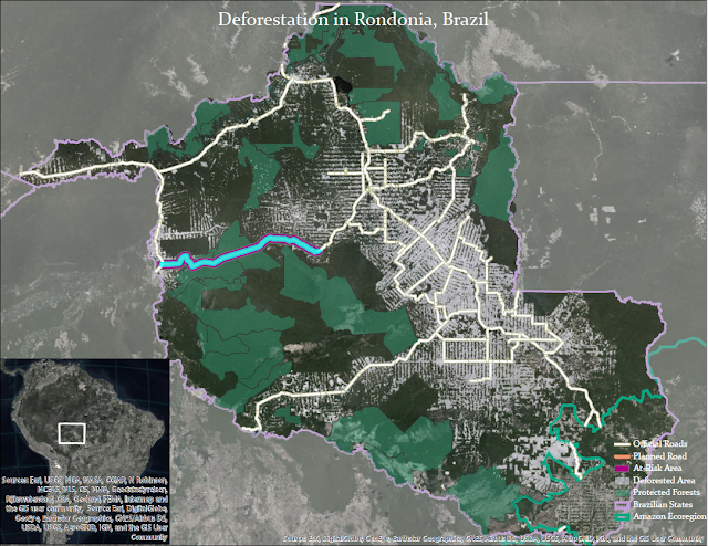 |
| Deforestation in Rondonia, Brazil |
3D Analysis of Surfaces and Features using ArcGIS
 |
| 3D Analysis Certificate |


